Events, homepage, News, Acadian Care – New Orleans, Access Health Louisiana Primary Care at Pythian, Belle Chasse Community Health Center, Kenner Community Health Center, South Broad Community Health Center, St. Bernard Community Health Center, St. Charles Community Health Center – Norco, St. Charles Community Health Center – Luling, St. Tammany – Slidell Community Health Center, Tangipahoa Community Health Center, Woodworth Community Health Center, Washington Community Health Center
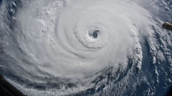
GET PREPARED FOR HURRICANE FRANCINE
MAKE SURE YOU ARE PREPARED FOR HURRICANE SEASON
Below is a list of recommended items to have on hand and things to do
TO GET TO DO
BATTERIES
CANDLES
FLASHLIGHTS
FIRST AID KIT
MAKE SURE YOUR MOBILE DEVICES ARE CHARGED
GET YOUR PORTABLE CHARGING DEVICES READY AND CHARGED
IMPORTANT DOCUMENTS
WATER
CANNED FOOD
KEEP GAS TANKS FULL
GO – KIT: 3 DAYS OF SUPPLIES TO CARRY WITH YOU
STAY AT HOME KIT: 2 WEEKS OF SUPPLIES
SUBSCRIBE TO YOUR LOCAL EMERGENCY ALERT SYSTEMS IN YOUR PARISH
(Below are a list of Parishes and links to their alert systems)
WEST FELICIANA
DSNAP
FEMA
RED CROSS
BLUE ROOF
CAJUN NAVY
READY.GOV
STATE OF LOUISIANA
EMERGENCY SHELTERS
- Restoration Church, located at 22494 US 190 in Robert;
- Amite Community Center, located at 212 E. Oak Street in Amite; and
- Brown’s Chapel, located at 70427 Martin Luther King Drive, in the Village of Tangipahoa.
AHL PHARMACY

The Saffir-Simpson Hurricane Wind Scale is a 1 to 5 rating based on a hurricane’s sustained wind speed. This scale estimates potential property damage. Hurricanes reaching Category 3 and higher are considered major hurricanes because of their potential for significant loss of life and damage. Category 1 and 2 storms are still dangerous, however, and require preventative measures. In the western North Pacific, the term “super typhoon” is used for tropical cyclones with sustained winds exceeding 150 mph. Note that all winds are using the U.S. 1-minute average.
| Category One Hurricane
Winds 74-95 mph (64-82 kt or 119-153 km/hr). Very dangerous winds will produce some damage: Well-constructed frame homes could have damage to roof, shingles, vinyl siding and gutters. Large branches of trees will snap and shallowly rooted trees may be toppled. Extensive damage to power lines and poles likely will result in power outages that could last a few to several days. Irene of 1999, Katrina of 2005, and several others were Category One hurricanes at landfall in South Florida. |
|
Category Two Hurricane Winds 96-110 mph (83-95 kt or 154-177 km/hr). Extremely dangerous winds will cause extensive damage: Well-constructed frame homes could sustain major roof and siding damage. Many shallowly rooted trees will be snapped or uprooted and block numerous roads. Near-total power loss is expected with outages that could last from several days to weeks. Frances of 2004 was a Category Two when it hit just north of Palm Beach County, along with at least 10 other hurricanes which have struck South Florida since 1894. |
|
Category Three Hurricane Winds 111-129 mph (96-112 kt or 178-208 km/hr). Devastating damage will occur: Well-built framed homes may incur major damage or removal of roof decking and gable ends. Many trees will be snapped or uprooted, blocking numerous roads. Electricity and water will be unavailable for several days to weeks after the storm passes. Unnamed hurricanes of 1909, 1910, 1929, 1933, 1945, and 1949 were all Category 3 storms when they struck South Florida, as were King of 1950, Betsy of 1965, Jeanne of 2004, and Irma of 2017. |
|
Category Four Hurricane Winds 130-156 mph (113-136 kt or 209-251 km/hr). Catastrophic damage will occur: Well-built framed homes can sustain severe damage with loss of most of the roof structure and/or some exterior walls. Most trees will be snapped or uprooted and power poles downed. Fallen trees and power poles will isolate residential areas. Power outages will last weeks to possibly months. Most of the area will be uninhabitable for weeks or months. The 1888, 1900, 1919, 1926 Great Miami, 1928 Lake Okeechobee/Palm Beach, 1947, Donna of 1960 made landfall in South Florida as Category Four hurricanes. |
|
Category Five Hurricane Winds 157 mph or higher (137 kt or higher or 252 km/hr or higher). Catastrophic damage will occur: A high percentage of framed homes will be destroyed, with total roof failure and wall collapse. Fallen trees and power poles will isolate residential areas. Power outages will last for weeks to possibly months. Most of the area will be uninhabitable for weeks or months. The Keys Hurricane of 1935 and Andrew of 1992 made landfall in South Florida as Category Five hurricanes. |


